1807 - 1869
Bell created six large scale plans of the Great Northern Coalfield published between 1843 and 1861.
1807 - 1869
Bell created six large scale plans of the Great Northern Coalfield published between 1843 and 1861.
Newcastle upon Tyne UK
John Thomas William Bell (1807-1869) - more usually referred to as J.T.W. Bell - was a civil engineer and land surveyor who worked with various mines and railways, mainly in the North East. Between 1842 and 1861 Bell surveyed the Great Northern Coalfield, which was made up of the Northumberland Coalfield to the north and the Durham Coalfield to the south, and produced six plans to a scale of 2½ inches to the mile. They are very detailed, showing mines, quarries, railways, noting landownership and boundaries, and provide an invaluable source of information for those studying the history of the region. Though, at the time they were advertised in local newspapers and sold for two guineas plain and three guineas coloured. They are also something of a work of art!
The Maps:
Entry written by Ian Wishop.
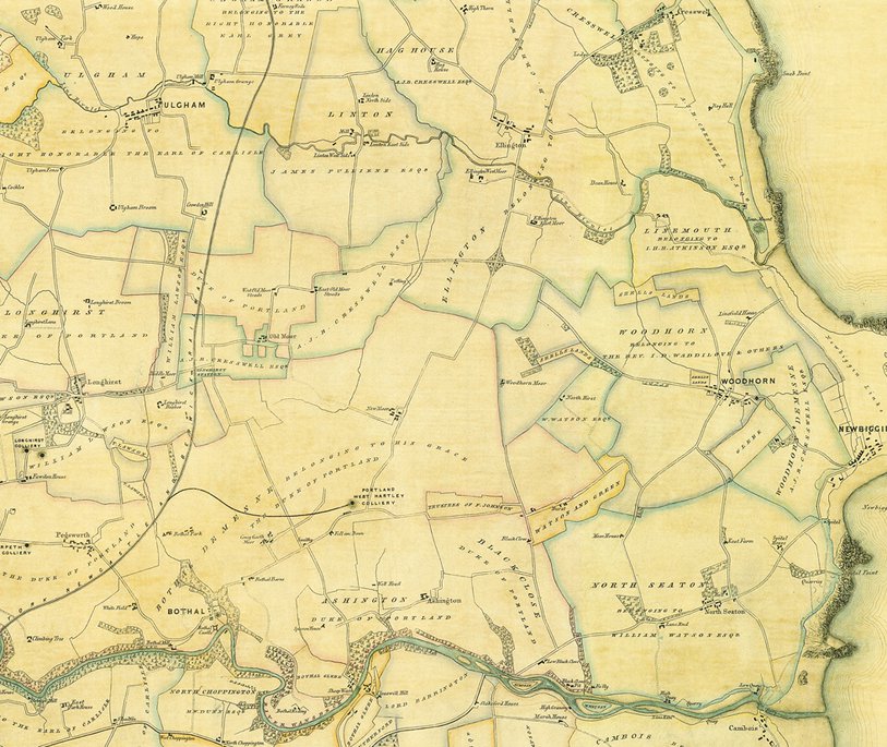
Bell's depiction on Blyth and Warkworth, focusing on Ashington. No known Copyright.
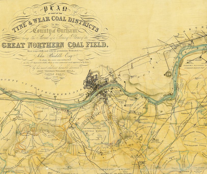
John Thomas Bell's maps - National Library of Scotland